[ad_1]
")
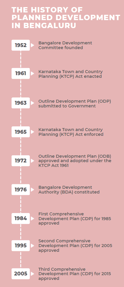
Bengaluru has a planning history spanning more than fifty years. The first step towards planning for development of Bengaluru City was initiated with the Outline Development Plan prepared by the Bangalore Development Committee in 1952.

The city’s planning got statutory backing in 1961 when the Karnataka Town And Country Planning (KTCP) Act, 1961 was enacted.
The history of planned development in Bengaluru is seen in the timeline below. The Bangalore Development Authority (BDA) is entrusted with the task of preparing a Comprehensive Development Plan (CDP) as per the KTCP Act.
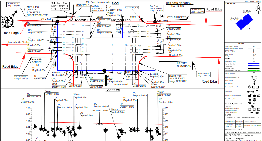
Throughout Bengaluru city’s planning history, thought to its future industrialisation, rapid urbanisation and utilities planning has been limited. To begin with, utilities were planned below roads, mainly to supply water and to carry sewage. Then came the underground power lines, telephone network and, later, private and other cable networks.
Any replacement, repair and maintenance for any of these utilities require permission for road-cutting, as roads are owned by the Bruhat Bengaluru Mahanagara Palike. If it is a peripheral road, it is the BBMP’s Major Roads wing that has to permit the digging. In residential areas, the ward office is the permitting authority.
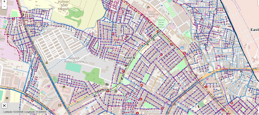
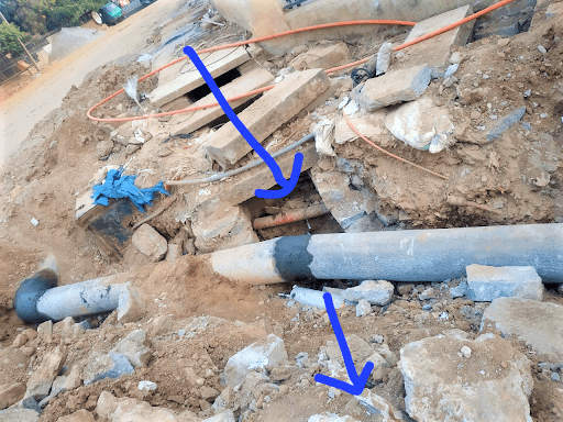
Over time, there have been several inclusions to this underground network of pipelines, wires and cables, what with multiple agencies digging in. However, none of it was recorded in the Master Plan. In other words, there is no master utilities map for the city.
Read more: Non-existent roads make it to Bengaluru master plan
Rapid urbanisation happened during the IT Boom. The city’s growth was clearly inorganic. The sudden surge in retail housing choked and overburdened Bengaluru’s utility infrastructure. There was a demand generated to upgrade or scale up the capacity of the power, sewer, water lines to support the population of the burgeoning city.
Urban utilities in Bengaluru work in silos. For instance, dissect an arterial road and its cross-section will consist of the following, and are managed by separate agencies:
| Sewage connection for Road Side properties | BWSSB Maintenance |
| Water connection for roadside properties | BWSSB Maintenance |
| One Sewage sub main | BWSSB WWM |
| Lateral sewage connections from the residential blocks | BWSSB Maintenance |
| HT power distribution | BESCOM |
| Telephone backbone | BSNL |
| HT Main | KPTCL |
| Roadside drains | BBMP Major Roads |
| Secondary drain Culvert | BBMP SWD |
| Dedicated Defence lines for water, power, telecom |
An unorchestrated excavation and replacing of their utility happens in sequence.
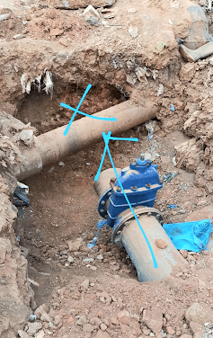
Each time a service provider digs the road, a new discovery is made; of another utility crossing its path. Or, another prime utility is simply damaged by earth-moving JCB power not knowing what is buried below. Such unscientific planning not only adds to the work of civic agencies and obstructs normal life for citizens, it overruns time and cost, all at the cost of the tax payer.
All this is the result of the owner of the road — BBMP — providing approval for road excavation in the absence of a utilities map. Had there been a system of updated city utilities maps and the requisition for road-cutting is run through the feasibility of the proposal, much of the hassle can be controlled at the permission stage itself. Valuable time and public money can be saved.
Read more: What happens to public objections on Bengaluru master plan?
There were no efforts found in the master plan to create a separate track for utilities until TenderSURE was implemented (But again TenderSURE is not a retro fit for all roads). Another case in point is Church Street, whose restructuring ensured the right mapping and alignment of utilities, thanks to its architect Naresh Narasimhan.
Right now, only BWSSB’s utilities like water lines, sanitary lines and sub-mains are mapped. These maps are available only for limited use as they are accessed only by the BWSSB, BBMP and the Urban Development Department.
This has to be integrated with all the other utility networks in the city and superimposed on a Master Utilities Map. Former BBMP Commissioner B H Anil Kumar had proposed a BBMP Dashboard to tag and map projects road-wise, including the utilities underneath the roads. That has remained a proposal.
it will prevent a lot of duplication of work, damaging utilities and wasting tax-payer’s money.
#UtilityMapBeku should be a campaign. Mapping these lifeline utilities for reference is the only way to flawless planning and execution of road excavation projects.
The wish list:
- Create a Master Utilities Map for Bengaluru which includes: BWSSB water main supply lines, internal supply network; BWSSB sewage submains, internal disposal network till submains, with chambers; KPTCL lines; BESCOM network; BSNL Telecom, backbone and network; internet backbone and internal network and dedicated lines for Defence.
2. One nodal agency to approve road-cutting, based on feasibility in Master Utilities Map and approval from other agencies.
3. A system to map all the proposed projects on a particular road and allow one road excavation only for all of them to be completed.
4. Any road in Bengaluru with heavy presence of utilities underground should not be eligible for white-topping. Multiple underground utilities require frequent repairs and breaking M40 grade concrete is disastrous
Also Read:
[ad_2]
Source link